Skip to content
Zhanna's SurveyStation
Menu
About
Recoveries
NGS Reports
USGS Reports
Search Recoveries
Map of Recoveries
Browse By Year
Local Databases
USGS Datasheets
Airway Beacons
About Airway Beacons
Eastern U.S.
Western U.S.
Map of Airway Beacons
Historical Airway Maps
Resources
Contact
Zhanna's SurveyStation
Menu
About
Recoveries
NGS Reports
USGS Reports
Search Recoveries
Map of Recoveries
Browse By Year
Local Databases
USGS Datasheets
Airway Beacons
About Airway Beacons
Eastern U.S.
Western U.S.
Map of Airway Beacons
Historical Airway Maps
Resources
Contact
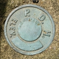
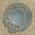
Agency:
PA Dept. of Highways
PDH
PA Dept. of Highways
,
USGS
Elevation Mark
Pennsylvania
Lackawanna County
Carbondale Quad
37 DSW
PA Dept. of Highways
,
USGS
Elevation Mark
Pennsylvania
Wayne County
Lake Ariel Quad
09-65-1005-1
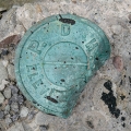
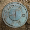
PA Dept. of Highways
Unspecified Disk
Pennsylvania
Wyoming County
Tunkhannock Quad
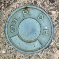
PDH
PA Dept. of Highways
Unspecified Disk
Pennsylvania
Northampton County
Wind Gap Quad
96-35-1013-2
PA Dept. of Highways
Unspecified Disk
Pennsylvania
Lackawanna County
Clifford Quad
04-63-0670-2
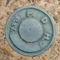
PA Dept. of Highways
Unspecified Disk
Pennsylvania
Wayne County
Aldenville Quad
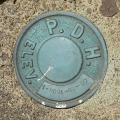
PDH
PA Dept. of Highways
Elevation Mark
Pennsylvania
Wyoming County
Center Moreland Quad
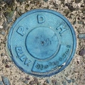
PDH
PA Dept. of Highways
Elevation Mark
Pennsylvania
Susquehanna County
Lenoxville Quad
98-0167-57-4
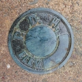
PA Dept. of Highways
Survey Control Mark
Pennsylvania
Susquehanna County
Hop Bottom Quad
I
PA Dept. of Highways
Survey Disk
Pennsylvania
Wayne County
Honesdale Quad
Older posts
Page
1
Page
2
Page
3
Next
→