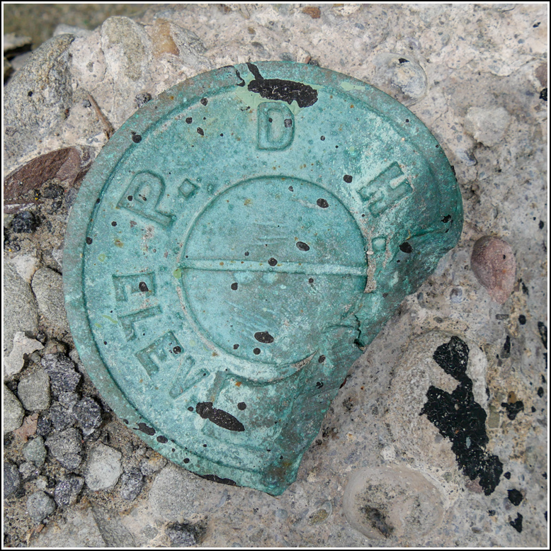
PDH
Spatial/elevation data
| Coordinates | N 41.59152° W 75.55501° |
| Elevation | 1561.838 ft. |
| Location | Pennsylvania
Lackawanna County Carbondale Quad |
Mark description
| Type | Elevation Mark |
| Setting | Bridge Wingwall |
| Monumented | Unknown by USGS |
| Description (USGS) | PDH description: Unavailable. USGS description—as reference mark for 35 ETL: 195 ft W. of tablet; on NE. headwall of bridge; Pennsylvania Department of Highways standard disk |
Narrative and photographs
For more information about this reference mark, see its parent mark 35 ETL.
Rich and I were enthusiastic about getting out of the house for a little local benchmark hunting this afternoon (I think the promise of pizza at the Waymart Hotel helped a lot, too!). My first goal was to search for a mark that I had somehow overlooked on the datasheet last time we were in this area—a PDH disk that serves as a reference mark for USGS bench mark 35 ETL. We realized there was a chance the grass had been cut since our visit in May and the USGS disk would be accessible too.
Unfortunately that wasn’t to be. The grass obviously has not been cut, and I’m not going to wade through it and pick up ticks on the way. But the PDH disk on the nearby bridge was an easy find and very easy to access. Rich even saw it from the car.
The disk appears to have been a victim of PennDOT’s aggressive plowing as one side of it is missing and the edge is curled up toward the center of the mark. With such damage I doubt it would be a reliable elevation mark, but it’s probably fine as a reference mark for 35 ETL.

