37 DSW
37 DSW
Spatial/elevation data
| Coordinates | N 41.45449° W 75.38136° |
| Elevation | 1433.810 ft. |
| Location | Pennsylvania
Wayne County Lake Ariel Quad |
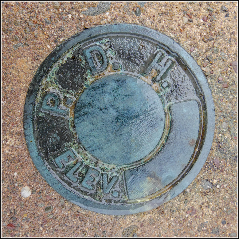
Mark description
| Type | Elevation Mark |
| Setting | Bridge Wingwall |
| Monumented | 1963 by USGS |
| Description (USGS) | Lake Ariel; about 0.13 mi W. of junction of State Highway 191 and U. S. Highway 296, along Highway 191; 100 ft W. of Wayne Diner; 15 ft S. of, and about level with centerline of rd. opposite; in SW. corner of wingwall of concrete bridge; PDH standard disk stamped “37 DSW 1963 USGS” |
Narrative and photographs
This afternoon Rich and I were on our way to a picnic at Lake Spangenberg, not far from Lake Ariel. I use such opportunities to seek out survey marks that we haven’t yet searched for … and of course there were a few on the list for today!
The first one we attempted was 37 DSW, right in the town of Lake Ariel, which we reached by winding back roads after coming over the mountain on Archbald Mountain Road. This PDH disk is set in the wingwall of an old concrete bridge along Route 191. The bridge passes over the aptly-named Ariel Creek.
The disk was easy to find and appears to be in good condition, but there’s still a bit of mystery here—I can’t really see the “37 DSW” that is supposed to be stamped on the disk! I think I can make out a very faint “3” but I don’t see any other signs of stamping. It’s clear this is the correct disk but I do wonder what happened to the stamping.

