Skip to content
Zhanna's SurveyStation
Menu
About
Recoveries
NGS Reports
USGS Reports
Search Recoveries
Map of Recoveries
Browse By Year
Local Databases
USGS Datasheets
Airway Beacons
About Airway Beacons
Eastern U.S.
Western U.S.
Map of Airway Beacons
Historical Airway Maps
Resources
Contact
Zhanna's SurveyStation
Menu
About
Recoveries
NGS Reports
USGS Reports
Search Recoveries
Map of Recoveries
Browse By Year
Local Databases
USGS Datasheets
Airway Beacons
About Airway Beacons
Eastern U.S.
Western U.S.
Map of Airway Beacons
Historical Airway Maps
Resources
Contact
Location:
Wayne County
222 LRP
USGS
Bench Mark Disk
Pennsylvania
Wayne County
White Mills Quad
223 LRP
USGS
Bench Mark Disk
Pennsylvania
Wayne County
White Mills Quad
OAK TREE LODGE
PennDOT
Survey Mark
Pennsylvania
Wayne County
Waymart Quad
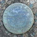
MOOSIC
NGS
Triangulation Station Disk
Pennsylvania
Wayne County
Waymart Quad
TTS 22 T
USGS
Bench Mark Disk
Pennsylvania
Wayne County
Waymart Quad
37 DSW
PA Dept. of Highways
,
USGS
Elevation Mark
Pennsylvania
Wayne County
Lake Ariel Quad
39 DSW
USGS
Bench Mark Disk
Pennsylvania
Wayne County
Lake Ariel Quad
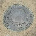
00-63-2006-2
PennDOT
Survey Control Mark
Pennsylvania
Wayne County
White Mills Quad
220 LRP
USGS
Bench Mark Disk
Pennsylvania
Wayne County
White Mills Quad
37 M
USGS
Bench Mark Disk
Pennsylvania
Wayne County
Forest City Quad
Older posts
Page
1
Page
2
…
Page
6
Next
→