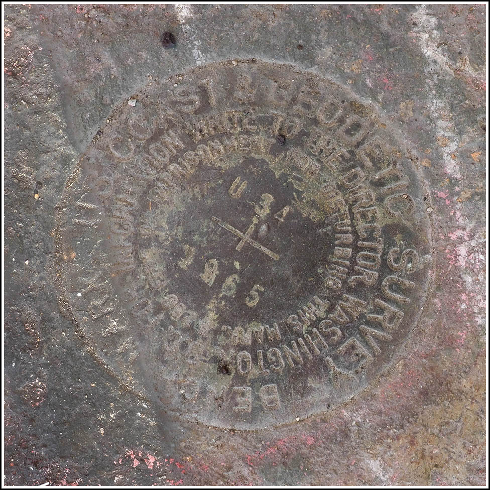
U 34 (LX0382)
U 34
Recovered in Good Condition on November 11, 2023
Spatial/elevation data
| Coordinates | N 41.300966° W 72.924084° |
| Elevation | 15.23 ft. |
| Location | Connecticut
New Haven County New Haven Quad |
Mark description
| Type | Bench Mark Disk |
| Setting | Bridge Pier |
| Monumented | 1965 by NGS |
| Description (NGS) | NGS Datasheet |
Narrative and photographs
This was the second benchmark we found today in New Haven, and unfortunately it wasn’t in such a great location. This was another mark, like the one on the railroad station, that we could see from Google Street View, so at least I didn’t have to spend much time poking around looking for it. My first thought was that this area was a homeless encampment, but it may have just been a dumping spot for trash. In any case, I didn’t want to hang around there for too long, so I documented the mark and moved on. For being relatively exposed, the disk is in good condition. It has been used in the not-too-distant past, as evidenced by the “BM” painted on the concrete nearby.


