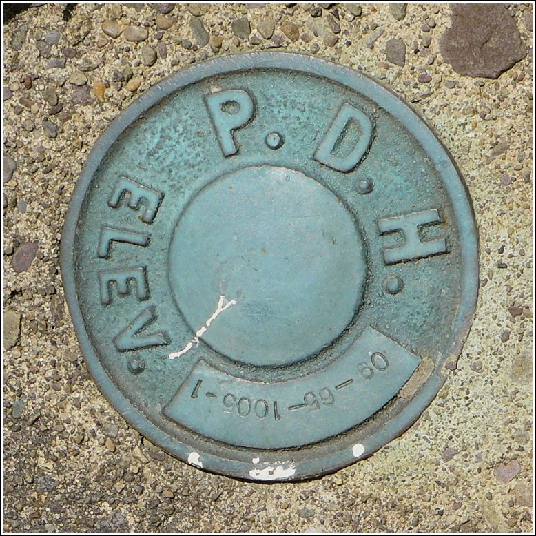
09-65-1005-1
09-65-1005-1
Recovered in Good Condition on July 26, 2016
Spatial/elevation data
| Coordinates | N 41.60684° W 75.93309° |
| Elevation | Unknown |
| Location | Pennsylvania
Wyoming County Tunkhannock Quad |
Mark description
| Type | Unspecified Disk |
| Setting | Bridge Wingwall |
| Monumented | 2009? by PA Dept. of Highways |
| Description (PA Dept. of Highways) | Unavailable. |
Narrative and photographs
Rich and I spent a fantastic morning in Montrose finishing up the third annual Architectural Treasure Hunt. After turning in our clue sheets, stopping for some chocolates and having lunch, we drove back home by way of Route 29. Along the way, it occurred to me that there was a new geocache near Lake Carey, so we took a short detour to search for it. We didn’t find the cache, but we did find this old PDH disk on the bridge nearby. It’s stamped with a new PennDOT number. It appears to be in good condition and quite stable.

