Arrow Northeast of Low, UT

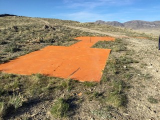
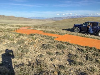
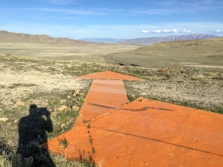
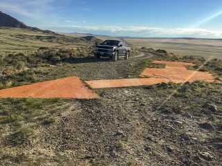
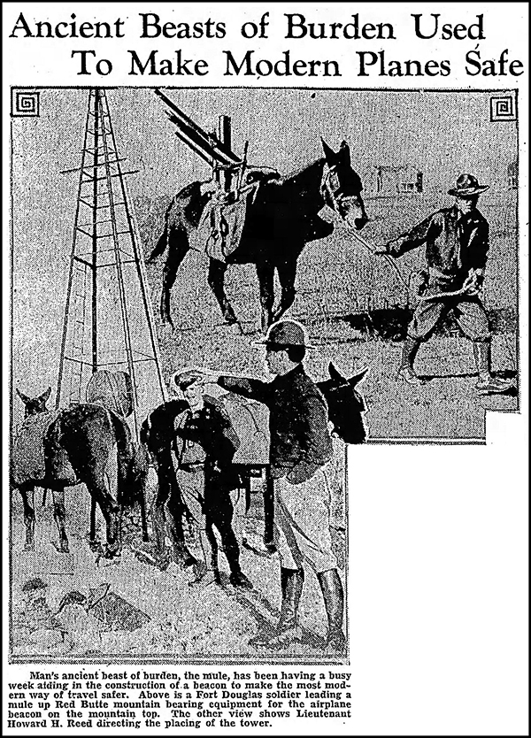
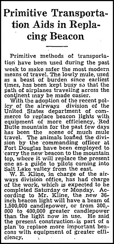
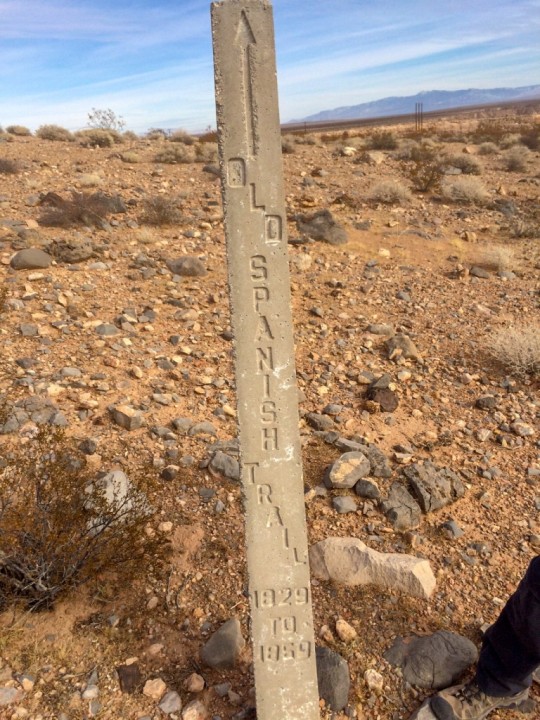
Dave Izatt has submitted the following photos of LP0496 – SAN FRANCIS SALT LK AWY BN 57. The tower is gone, but the arrow is intact. Dave says that a 4-wheel drive vehicle with high clearance is required to drive directly to the arrow.

The beacon tower’s description is difficult to find now, because it has been marked as Destroyed in the NGS database. Below is the original Coast & Geodetic Survey description written upon their observation of the site in 1940. Strangely, they claim “There is no concrete arrow to indicate the course.” Is this a mistake in the description? I can’t imagine the arrow having been added after 1940. Also of interest is that (according to Wikipedia) Low is a ghost town, abandoned in 1955 due to lack of local water.

ON A LOW RANGE OF HILLS E OF THE GREAT SALT LAKE DESERT. 28.5 MILES NW OF GRANTSVILLE, UTAH, AND 5 MILES NE OF LOW, UTAH. LOW IS PAINTED IN LARGE WHITE LETTERS ON THE SIDE OF THE HILL. AND ABOUT 0.8 MILE N OF U.S. HIGHWAY 40, ON TOP OF A SMALL HILL.

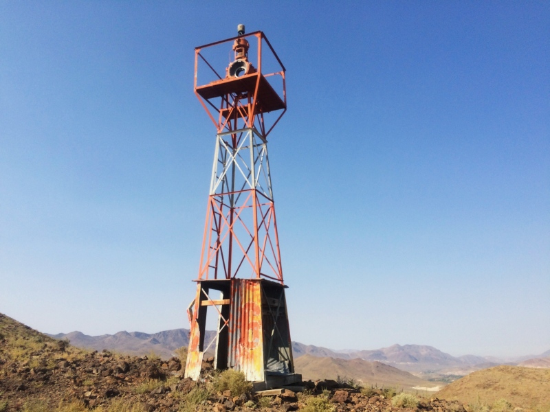
THE BEACON IS A STANDARD RED AND WHITE-STRIPED, ROTATING, AIRWAY BEACON, ABOUT 60 FEET HIGH. THERE IS A SUPPLY AND CONTROL HOUSE AND A LARGE RESIDENCE ON THE SIDE HILL, ABOUT 400 YARDS FROM AND 200 FEET BELOW THE BEACON. THERE IS NO CONCRETE ARROW TO INDICATE THE COURSE.

Thanks, Dave, for your contribution!

GPS on Bench Marks—Volunteer Opportunity!

Fellow survey mark hunters, please consider helping NGS with this year’s GPS on Bench Marks initiative. Data submitted by August 31, 2018 will help in the development of the new geoid, GEOID18!

All observations are welcome. If you don’t have professional surveying equipment, no problem—please submit your observations, including field notes and photographs, to assist those who have pro equipment in finding the mark!

And don’t forget, even with consumer-grade GPS equipment such as a handheld unit or phone, you can always update the coordinates for marks with SCALED positions.

To help focus efforts, NGS publishes a map of prioritized marks. These are selected marks that, if found and if observations are submitted, will help improve the new geoid. The list of prioritized marks is also available in Excel and other formats.

2018 Web Map

Prioritized Marks (.xslx)

Frequently Asked Questions

GPS on Bench Marks Home Page

1932 Newspaper Article: New Beacon on Red Butte Mountain near Salt Lake City, UT

Website contributor Dave DuPree has found the following image and article in The Salt Lake Tribune from Saturday, November 26, 1932 (page 33). This is the article to which Dave referred in his comment on the Needle Peak video. Thanks, Dave!


Image caption:

Man’s ancient beast of burden, the mule, has been having a busy week aiding in the construction of a beacon to make the most modern way of travel safer. Above is a Fort Douglas soldier leading a mule up Red Butte mountain bearing equipment for the airplane beacon on the mountain top. The other view shows Lieutenant Howard H. Reed directing the placing of the tower.

Full article:

Primitive Transportation Aids in Replacing Beacon

Primitive methods of transportation have been used during the past week to make safer the most modern means of travel. The lowly mule, used as a beast of burden since earliest times, has been kept busy so that the path of airplanes traveling across the continent may be made easier.

With the adoption of the recent policy of the airways division of the United States department of commerce to replace beacon lights with equipment of more efficiency, Red Butte mountain for the past few days has been the scene of much mule travel. The animals loaned the division by the commanding officer at Fort Douglas have been employed to carry the new beacon to the mountain top, where it will replace the present one as a guide to pilots coming into Salt Lake valley from the east.

W. E. Kline, in charge of the airways division office, has had charge of the work, which is expected to be completed Saturday or Monday. According to Mr. Kline, the new 36-inch beacon light will have a beam of 1,500,000 candlepower, or from 300,000 to 400,000 greater candlepower than the light now in use. He said the present construction is part of a plan to replace more important beacons with equipment of greater efficiency.

Arrow Near Glendale, NV

Art Young of the Ardiente Community Hiking Enthusiasts (ACHE) has submitted these photographs of the arrow associated with Los Angeles—Salt Lake Airway Beacon 31A (NGS PID GR1900). The arrow, which is referred to in the linked survey datasheet, is about 700 feet east of the former beacon site. The arrow has been painted orange since the images in Google’s satellite view were captured. It appears to be in excellent condition.

Art also noted that the Old Spanish Trail passes just a few hundred yards to the southwest of the arrow. The route of the Old Spanish Trail is mapped here: ArcGIS Old Spanish Trail Map.

Thanks for your contribution, Art!

Bud Coffee Field and Hangar #1 in Modesto, California

I’m so grateful to Gene Gomes for contributing the following diagrams of Bud Coffee Field and Hangar #1 in Modesto, California.

Gene explained:

Bud Coffee Field was the original airfield of Modesto, CA prior to construction of the new airport location. Bud Coffee Field lives on now as the Modesto Muni Golf Course.

Hangar #1 still exists at the (newer) Modesto Airport, and resides on the general aviation side of the airport, just off Runway 28L, on Tioga Drive. It is visible in aerial/satellite photos.

The images below link to the full-size PDFs. The Bud Coffee Field diagram contains three pages, so be sure to check them out!

Bud Coffee Field

Hangar #1, Modesto City Airport

Map of locations

Beacon Tower Near Fernley, NV

Ken Nussear has submitted the following photographs of an intact beacon tower near Fernley, Nevada. He also discovered at Arrows Across America that the beacon was designated “216 SF-SL” on the Reno-Elko section of the San Francisco—Salt Lake route.

Coordinates of the tower are N 39.608274° W 119.289933°.

The intact tower
The intact tower
Inside the tower base

Pre-NGS Survey Data Sheets—Now with Images!

Harold Nelson of MaineDOT has sent along old horizontal control datasheets from Hancock County, Maine. These were developed when the Coast & Geodetic Survey (now the NGS) was a component of the ESSA, Environmental Sciences Services Administration. The ESSA was reorganized into NOAA in 1970.

Download sheets

These sheets are reminiscent of the USGS datasheets, which still exist only in a similar paper format. Note there are only designations, no PIDs—PIDs were not assigned until the NGS database was created and marks were entered. Some of these datasheets contain sketches that do not exist in the online NGS database! (If you’ve ever seen a recovery note that referred to a sketch or drawing, and wondered where it was—well, it was on sheets like these.)

As an example, see the sheet for POR, on Sheep Porcupine Island:

And for LOP, at Lopaus Point: