Skip to content
Zhanna's SurveyStation
Menu
About
Recoveries
NGS Reports
USGS Reports
Search Recoveries
Map of Recoveries
Browse By Year
Local Databases
USGS Datasheets
Airway Beacons
About Airway Beacons
Eastern U.S.
Western U.S.
Map of Airway Beacons
Historical Airway Maps
Resources
Contact
Zhanna's SurveyStation
Menu
About
Recoveries
NGS Reports
USGS Reports
Search Recoveries
Map of Recoveries
Browse By Year
Local Databases
USGS Datasheets
Airway Beacons
About Airway Beacons
Eastern U.S.
Western U.S.
Map of Airway Beacons
Historical Airway Maps
Resources
Contact
Marker Type:
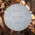
Boundary Monument
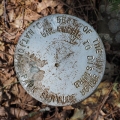
NPS (Unstamped, Acadia #15)
National Park Service
Boundary Monument
Salsbury Cove Quad
Maine
Hancock County
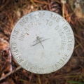
NPS (Unstamped, Acadia #14)
National Park Service
Boundary Monument
Salsbury Cove Quad
Maine
Hancock County
NPS (Unstamped, Acadia #10)
National Park Service
Boundary Monument
Salsbury Cove Quad
Maine
Hancock County
NPS (Unstamped, Acadia #11)
National Park Service
Boundary Monument
Salsbury Cove Quad
Maine
Hancock County
NPS (Unstamped, Acadia #12)
National Park Service
Boundary Monument
Salsbury Cove Quad
Maine
Hancock County
NPS (Unstamped, Acadia #13)
National Park Service
Boundary Monument
Salsbury Cove Quad
Maine
Hancock County
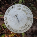
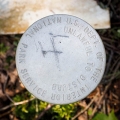
S 223
National Park Service
Boundary Monument
Seal Harbor Quad
Maine
Hancock County
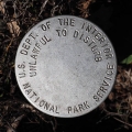
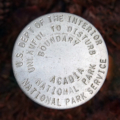
J 3
National Park Service
Boundary Monument
Seal Harbor Quad
Maine
Hancock County
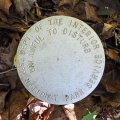
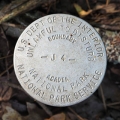
J 4
National Park Service
Boundary Monument
Seal Harbor Quad
Maine
Hancock County
NPS (Unstamped, Acadia #9)
National Park Service
Boundary Monument
Maine
Hancock County
Older posts
Page
1
Page
2
…
Page
4
Next
→