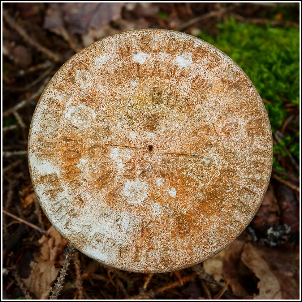
S 223
S 223
Recovered in Good Condition on September 15, 2023
Spatial/elevation data
| Coordinates | N 44.30199° W 68.219547° |
| Elevation | Unknown |
| Location | Maine
Hancock County Seal Harbor Quad |
Mark description
| Type | Boundary Monument |
| Setting | Steel Pipe |
| Monumented | Unknown by National Park Service |
Narrative and photographs
Rich and I hiked down the Hunters Beach trail this morning, and at one point I spotted an NGS boundary marker east of the trail and down a steep slope. After exploring the cobble beach, I documented the boundary marker on our return hike. It has some pitting or corrosion on the surface of the disk, but for now the designation is still legible. The slope is much steeper than it looks in the photos, so this was a tricky one to photograph!

