Skip to content
Zhanna's SurveyStation
Menu
About
Recoveries
NGS Reports
USGS Reports
Search Recoveries
Map of Recoveries
Browse By Year
Local Databases
USGS Datasheets
Airway Beacons
About Airway Beacons
Eastern U.S.
Western U.S.
Map of Airway Beacons
Historical Airway Maps
Resources
Contact
Zhanna's SurveyStation
Menu
About
Recoveries
NGS Reports
USGS Reports
Search Recoveries
Map of Recoveries
Browse By Year
Local Databases
USGS Datasheets
Airway Beacons
About Airway Beacons
Eastern U.S.
Western U.S.
Map of Airway Beacons
Historical Airway Maps
Resources
Contact
Location:
Monroe County
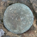
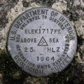
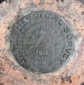
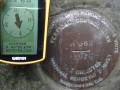
CAMELBACK
NGS
Triangulation Station Disk
Pennsylvania
Monroe County
Mount Pocono Quad
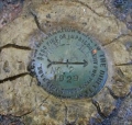
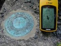
25 HLZ
USGS
Bench Mark Disk
Pennsylvania
Monroe County
Stoddartsville Quad
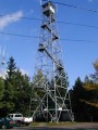
DANCING RIDGE FIRE TOWER
NGS
Landmark/Intersection Station
Pennsylvania
Monroe County
Skytop Quad
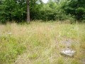
DLW
USGS
Survey Mark
Pennsylvania
Monroe County
Tobyhanna Quad
PIMPLE HILL RM 2
NGS
Reference Mark Disk
Pennsylvania
Monroe County
Blakeslee Quad
PIMPLE HILL RM 1
NGS
Reference Mark Disk
Pennsylvania
Monroe County
Blakeslee Quad
PIMPLE HILL RESET
NGS
Triangulation Station Disk
Pennsylvania
Monroe County
Blakeslee Quad
PIMPLE HILL LOOKOUT TOWER
NGS
Landmark/Intersection Station
Pennsylvania
Monroe County
Blakeslee Quad
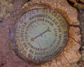
H 362
NGS
Vertical Control Mark
Pennsylvania
Monroe County
Stroudsburg Quad
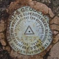
G 224
NGS
Bench Mark Disk
Pennsylvania
Monroe County
Mount Pocono Quad
Older posts
Newer posts
←
Previous
Page
1
Page
2
Page
3
Next
→