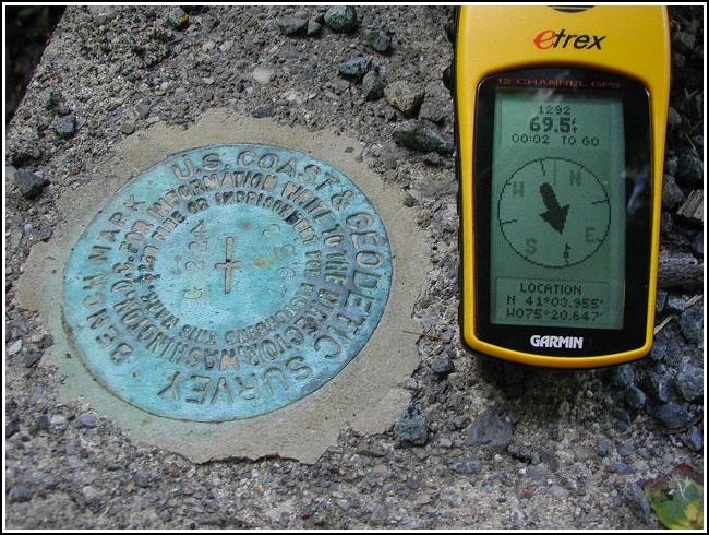
G 224 (LY1292)
G 224
Recovered in Good Condition on September 13, 2002
Spatial/elevation data
| Coordinates | N 41.065916° W 75.344116° |
| Elevation | 1240.90 ft. |
| Location | Pennsylvania
Monroe County Mount Pocono Quad |
Mark description
| Type | Bench Mark Disk |
| Setting | Bridge Wingwall |
| Monumented | 1958 by NGS |
| Description (NGS) | NGS Datasheet |
NGS recovery information
Descriptive text
Recovered in good condition in headwall of bridge over Transue Run. The road is now designated S.R. 4004 (Sullivan Trail). Handheld GPS coordinates for the bench mark are 41 03 57.3(N) 075 20 38.8(W).Narrative and photographs
Found it late this afternoon after locating the nearby ‘Chipmunk Haven’ geocache. This was a very easy marker to find, and there’s a convenient spot to park just a few feet from the bridge. I ran over to the bridge, hopped over the guardrail and found the benchmark immediately; I took a few quick photos as the traffic rushed by beside me. (It seemed more like Interstate 81 than County Road 45024!) Coordinates weren’t a bad match, but the description was right on and that’s what led me directly to the mark.
