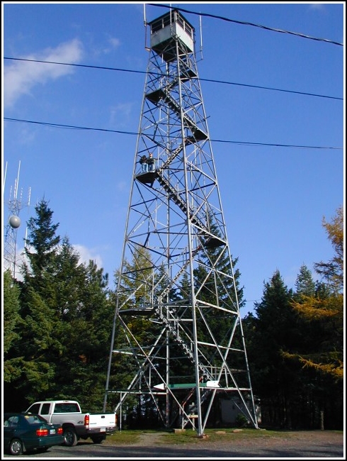
PIMPLE HILL LOOKOUT TOWER (LY2738)
PIMPLE HILL LOOKOUT TOWER
Recovered in Good Condition on October 27, 2002
Spatial/elevation data
| Coordinates | N 41.026733° W 75.50495° |
| Elevation | Unknown |
| Location | Pennsylvania
Monroe County Blakeslee Quad |
Mark description
| Type | Landmark/Intersection Station |
| Setting | Fire Lookout Tower |
| Monumented | 1955 by NGS |
| Description (NGS) | NGS Datasheet |
NGS recovery information
Descriptive text
Recovered in good condition as described. The tower is located on Delaware State Forest land.Narrative and photographs
Very easy to find this one! You can’t miss it. It’s an especially nice tower because visitors are permitted to climb it. (Not that it isn’t somewhat unnerving.)

