Skip to content
Zhanna's SurveyStation
Menu
About
Recoveries
NGS Reports
USGS Reports
Search Recoveries
Map of Recoveries
Browse By Year
Local Databases
USGS Datasheets
Airway Beacons
About Airway Beacons
Eastern U.S.
Western U.S.
Map of Airway Beacons
Historical Airway Maps
Resources
Contact
Zhanna's SurveyStation
Menu
About
Recoveries
NGS Reports
USGS Reports
Search Recoveries
Map of Recoveries
Browse By Year
Local Databases
USGS Datasheets
Airway Beacons
About Airway Beacons
Eastern U.S.
Western U.S.
Map of Airway Beacons
Historical Airway Maps
Resources
Contact
Location:
Hancock County
BASS
Army Corps of Engineers
Survey Mark
Bass Harbor Quad
Maine
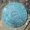
Hancock County
K 19
USGS
Bench Mark Disk
Maine
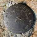
Hancock County
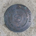
841 3320 TIDAL G
National Ocean Service
Tidal Bench Mark Disk
Bar Harbor Quad
Maine
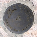
Hancock County
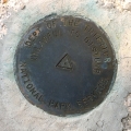
LONG POND FIRE ROAD
National Park Service
Triangulation Station Disk
Bartlett Island Quad
Maine
Hancock County
H 145
NGS
Bench Mark Disk
Bartlett Island Quad
Maine
Hancock County
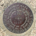
K 14
USGS
Bench Mark Disk
Southwest Harbor Quad
Maine
Hancock County
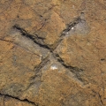
TIDAL 4 STA 13
NGS
Chiseled Cross
Bass Harbor Quad
Maine
Hancock County
TIDAL 6 STA 13
NGS
Tidal Bench Mark Disk
Bass Harbor Quad
Maine
Hancock County
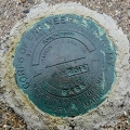
WONDERLAND
National Park Service
Triangulation Station Disk
Bass Harbor Quad
Maine
Hancock County
GHEAD
National Park Service
Triangulation Station Disk
Seal Harbor Quad
Maine
Hancock County
Older posts
Newer posts
←
Previous
Page
1
…
Page
3
Page
4
Page
5
…
Page
20
Next
→