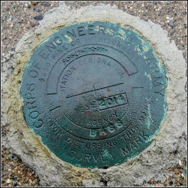
BASS
BASS
Recovered in Good Condition on September 11, 2018
Spatial/elevation data
| Coordinates | N 44.240827° W 68.3522° |
| Elevation | 2.825 ft. |
| Location | Maine
Hancock County Bass Harbor Quad |
Mark description
| Type | Survey Mark |
| Setting | Concrete Slab |
| Monumented | 2014 by Army Corps of Engineers |
| Description (Army Corps of Engineers) | Bass 2014 is a USACE brass disk set flush in the NW corner of a concrete pad that anchors the float system on the south side of the paved public boat ramp at Bass Harbor in Tremont, ME. The Ramp is located at the east end of Rice rd. The station is 29.23’ south of REF 1, a 1/4” dh in a chiseled sq on the north concrete pad, 11.18’ west of the NE corner of the south concrete pad, 20.02’ NW of REF 2 a 1/4” dh in a chiseled sq in a concrete wall and 5.02’ NE of a 4’ high concrete filled steel Post. |
Narrative and photographs
See also: Shared Solution for BASS 2014
BASS 2014 is a U.S. Army Corps of Engineers disk set at the wharf along Rice Road where we found two survey markers (TIDAL 4 STA 13 and TIDAL 6 STA 13) last year. We did investigate all around the wharf at that time, so it’s a bit of a mystery how we could have missed this mark that was supposedly set in 2014. We drove right up to it today and found the mark in excellent condition. I took my photos in the misty rain and Rich found a lovely harbor scene for a photo as well.


