- NGS PID:
- AA0280
- Coordinates:
- N 24.68264° W 81.22854°
- Location:
- Elevation:
- 3.68 ft.

- Type:
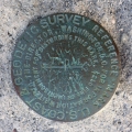
- Reference Mark Disk
- Setting:
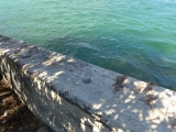
- Bridge Wingwall
- Year Established:
- 1937
- Established By:
- NGS
- Status:
- Recovered
- Condition:
- Good as of February 18, 2016
- Official Description: NGS Datasheet
For more information, see: DUCK 2
A report on the condition of this survey mark has been submitted to NGS, along with the following recovery note:
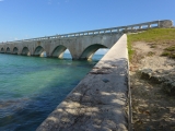
Recovered in good condition on the north wingwall at the west end of the old seven mile bridge. This section of the former bridge is now a fishing pier and part of a recreational trail. The current Seven Mile Bridge is directly south of the old bridge.
For more information, see: DUCK 2


