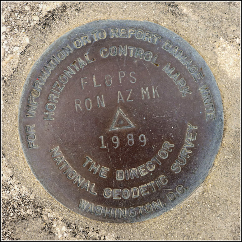
FLGPS RON AZ MK (AC4658)
Recovered in Good Condition on February 16, 2016
Spatial/elevation data
| Coordinates | N 25.762071° W 80.774706° |
| Elevation | 18.18 ft. |
| Location | Florida
Miami-Dade County Fortymile Bend Quad |
Mark description
| Type | Horizontal Control Disk |
| Setting | Bridge Abutment |
| Monumented | 1989 by NGS |
| Description (NGS) | NGS Datasheet |
Narrative and photographs
For more information about this reference mark, see its parent mark FLGPS RON.

