39 DSW
39 DSW
Recovered in Good Condition on July 4, 2016
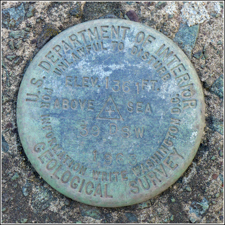
Spatial/elevation data
| Coordinates | N 41.430316° W 75.427416° |
| Elevation | 1361.372 ft. |
| Location | Pennsylvania
Wayne County Lake Ariel Quad |
Mark description
| Type | Bench Mark Disk |
| Setting | Bridge Wingwall |
| Monumented | 1963 by USGS |
| Description (USGS) | Maplewood; 15 ft N. of, and about level with center of bridge; in SW. corner of N. wingwall of concrete bridge over Silkmans Swamp; standard tablet stamped “39 DSW 1963 1361” |
Narrative and photographs
One more mark in the DSW series was planned for today. Rich and I made a loop around Lake Spangenberg and through Maplewood on the way to our traditional 4th of July picnic. The bridge that 39 DSW is set into hasn’t been replaced, as have most of the other small bridges in this area. The mark is set in a wingwall of the bridge, but I’m not sure I would describe it as the north wingwall; it’s more like the southeast wingwall. It is northeast of the centerline of the road over the bridge. The mark is in good condition and the wingwall and abutments seem solid, but the bridge deck appears to be crumbling and if it is eventually replaced, the mark may be in danger.

