Skip to content
Zhanna's SurveyStation
Menu
About
Recoveries
NGS Reports
USGS Reports
Search Recoveries
Map of Recoveries
Browse By Year
Local Databases
USGS Datasheets
Airway Beacons
About Airway Beacons
Eastern U.S.
Western U.S.
Map of Airway Beacons
Historical Airway Maps
Resources
Contact
Zhanna's SurveyStation
Menu
About
Recoveries
NGS Reports
USGS Reports
Search Recoveries
Map of Recoveries
Browse By Year
Local Databases
USGS Datasheets
Airway Beacons
About Airway Beacons
Eastern U.S.
Western U.S.
Map of Airway Beacons
Historical Airway Maps
Resources
Contact
Location:
Apache County
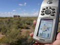
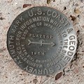
DESERT PARK ATT RELAY TOWER
NGS
Landmark/Intersection Station
Arizona
Apache County
Kachina Point Quad
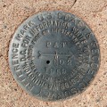
PAT RM 2
NGS
Reference Mark Disk
Arizona
Apache County
Kachina Point Quad
PAT RM 1
NGS
Reference Mark Disk
Arizona
Apache County
Kachina Point Quad
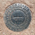
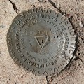
PAT
NGS
Triangulation Station Disk
Arizona
Apache County
Kachina Point Quad
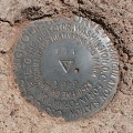
DESERT PARK RM 2
NGS
Reference Mark Disk
Arizona
Apache County
Kachina Point Quad
DESERT PARK RM 1
NGS
Reference Mark Disk
Arizona
Apache County
Kachina Point Quad
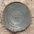
DESERT PARK
NGS
Triangulation Station Disk
Arizona
Apache County
Kachina Point Quad
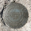
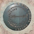
FLATTOP AZ MK
USGS
Azimuth Mark Disk
Arizona
Apache County
Agate House Quad
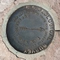
FLATTOP RM 2
USGS
Reference Mark Disk
Arizona
Apache County
Agate House Quad
FLATTOP RM 1
USGS
Reference Mark Disk
Arizona
Apache County
Agate House Quad
Older posts
Page
1
Page
2
Next
→