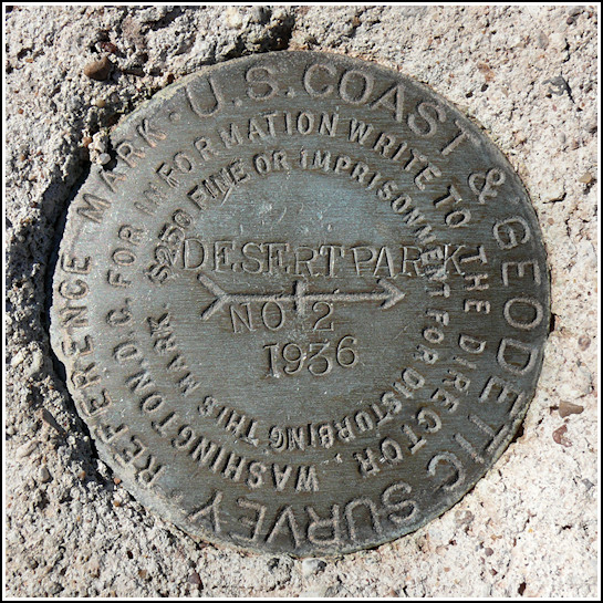
DESERT PARK RM 2 (FP0272)
Recovered in Good Condition on September 19, 2008
Spatial/elevation data
| Coordinates | N 35.075583° W 109.76945° |
| Elevation | 5815.96 ft. |
| Location | Arizona
Apache County Kachina Point Quad |
Mark description
| Type | Reference Mark Disk |
| Setting | Square Concrete Monument |
| Monumented | 1936 by NGS |
| Description (NGS) | NGS Datasheet |
NGS recovery information
Descriptive text
The disk was recovered in good condition, however the monument has cracked and the soil surrounding the monument has undergone severe erosion, exposing all four sides of the concrete to a depth of about 20 inches. The monument appears to be straight and stable, but it may have shifted. Interstate 40 now follows the path of the former U.S. Highway 66 in this area. Access the mark via the Petrified Forest exit from I-40 (exit 311). Follow Park Road in a generally northeasterly direction for approximately 1 mile to a park service road on the right. Follow the service road approximately 0.6 miles northeasterly to the station and reference marks on the right.Narrative and photographs
For more information about this reference mark, see its parent mark DESERT PARK.


