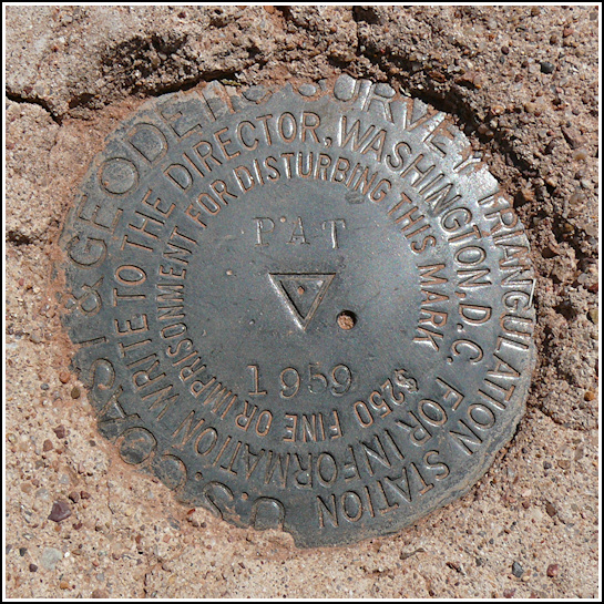
PAT (FP0411)
PAT
Spatial/elevation data
| Coordinates | N 35.0439° W 109.8007° |
| Elevation | 5684.76 ft. |
| Location | Arizona
Apache County Kachina Point Quad |
Mark description
| Type | Triangulation Station Disk |
| Setting | Square Concrete Monument |
| Monumented | 1959 by NGS |
| Description (NGS) | NGS Datasheet |
NGS recovery information
Descriptive text
The station and reference marks 1 and 2 were found in good condition as described. The distance from the road given in the 1983 recovery note is correct. The witness post is still in place. The azimuth mark was not found. Reference mark 1 is described twice in the 1959 monumentation note. Disregard the first description because it appears to be an inadvertent duplication of the station mark description. The second paragraph describing RM 1 is accurate. Handheld GPS coordinates for RM 1 are 35 02 38.0(N) 109 48 02.2(W). Handheld GPS coordinates for RM 2 are 35 02 37.7(N) 109 48 02.6(W).Narrative and photographs
Somehow we had some energy left after our crazy hike to FLATTOP on a butte near Petrified Forest Road. We continued north on the road to look for the tri-station PAT. The station and reference marks were all easy finds not far off the road; what we found most interesting about this area was the rainbow of small stones (some petrified wood) covering the desert floor. I’ve never seen anything like it!
We had no luck finding the azimuth mark, unfortunately. We had used the information available in the description and box score to estimate the location, and when we found nothing there we expanded our search considerably, even to the point where we were just driving up and down the road very slowly to see if we might spot the iron pipe projecting 12 inches. It would be great to give this one another try when we’re in the area again!


| Designation | Status | Condition | Image |
|---|---|---|---|
| PAT RM 1 | Recovered | Good |
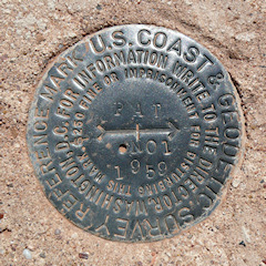
|
| PAT RM 2 | Recovered | Good |
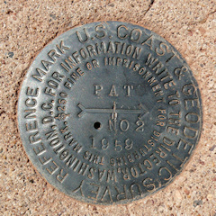
|