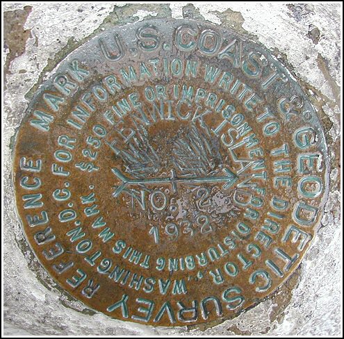
- NGS PID:
- HU1443
- Coordinates:
- N 38.451252° W 75.054948°
- Location:
- Elevation:
- 10 ft.

- Type:
- Reference Mark Disk
- Setting:
- Concrete Post
- Year Established:
- 1932
- Established By:
- NGS
- Status:
- Recovered
- Condition:
- Good as of August 31, 2003
- Official Description: NGS Datasheet
For more information, see: FENWICK ISLAND
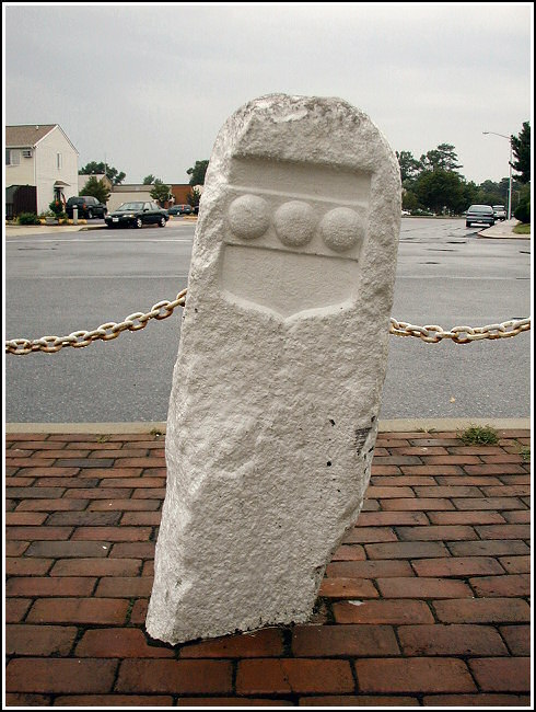
This reference mark disk was found in good condition as described, atop the Transpeninsular Line monument stone just south of the Fenwick Island Lighthouse. The 252 year old monument is part of a line that was surveyed to settle a boundary dispute between the Penns and the Calverts, and which established the middle point of the peninsula. The historic description was adequate to locate the mark, but the following changes should be noted: State Road 14 is now State Highway 1, and the sand road is now paved and is labeled 146th Street.


For more information, see: FENWICK ISLAND