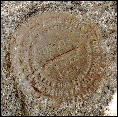
THROOP RM 2
Recovered in Good Condition on August 19, 2003
Spatial/elevation data
| Coordinates | N 41.435767° W 75.626083° |
| Elevation | Unknown |
| Location | Pennsylvania
Lackawanna County Scranton Quad |
Mark description
| Type | Reference Mark Disk |
| Setting | Square Concrete Monument |
| Monumented | 1959 by NGS |
Narrative and photographs
For more information about this reference mark, see its parent mark THROOP.
")


