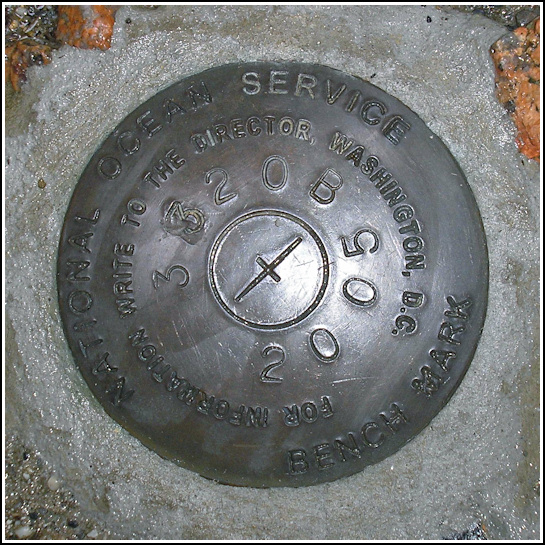
841 3320 TIDAL B
841 3320 TIDAL B
Recovered in Good Condition on June 26, 2006
Spatial/elevation data
| Coordinates | N 44.390783° W 68.20375° |
| Elevation | Unknown |
| Location | Maine
Hancock County Bar Harbor Quad |
Mark description
| Type | Tidal Bench Mark Disk |
| Setting | Concrete Base |
| Monumented | 2005 by National Ocean Service |
| Description (National Ocean Service) | The bench mark is a disk set in the foundation of two large black canons in Agamant Park, 16.37 m (53.6 ft) south of the black steel fence at the sea wall, 14.87 m (48.8 ft) SW of the SW face of the white gazebo, 9.45 m (31.0 ft) east of the centerline of Agamant Lane, 5.88 m (19.3 ft) ESE of the light pole NO. C45129, 0.3 m (1 ft) east of the west canon, and 0.3 m (1 ft) west of the east canon. |
Narrative and photographs
I only knew about this mark before our trip thanks to Papa-Bear-NYC on Geocaching.com. It’s located between the famous cannons overlooking the harbor and is one of the neatest settings I’ve seen. With a monumentation date of 2005, it’s brand new and the datasheet doesn’t even appear on NOS’s website yet. We found this mark on a drizzly-morning walk around town, after locating several other marks nearby (AI8315, Tidal 11, Tidal 13, and Tidal 14).


