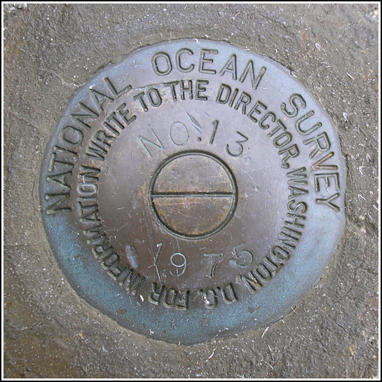
841 3320 TIDAL 13
841 3320 TIDAL 13
Recovered in Good Condition on June 26, 2006
Spatial/elevation data
| Coordinates | N 44.3913° W 68.204033° |
| Elevation | 6.487 m. |
| Location | Maine
Hancock County Bar Harbor Quad |
Mark description
| Type | Tidal Bench Mark Disk |
| Setting | Concrete Boat Ramp |
| Monumented | 1975 by National Ocean Service |
| Description (National Ocean Service) | The primary bench mark is a disk set in the concrete boat ramp NNE of the foot of Main Street at the SE corner of the Municipal Pier, 16.76 m (55.0 ft) ESE of the centerline of the pier parking lot, 3.11 m (10.2 ft) WNW of the centerline of the boat ramp, 2.16 m (7.1 ft) SE of a light pole at the foot of Main Street, and 0.09 m (0.3 ft) above the parking lot. |
Narrative and photographs
This disk was very easy to find, right on the corner of the boat ramp at the Municipal Pier. It was a drizzly day, but the sun came out while we were wandering around on the pier. It was a perfect day for watching the boats in the harbor. The disk is in good condition and undisturbed despite its exposed location.

