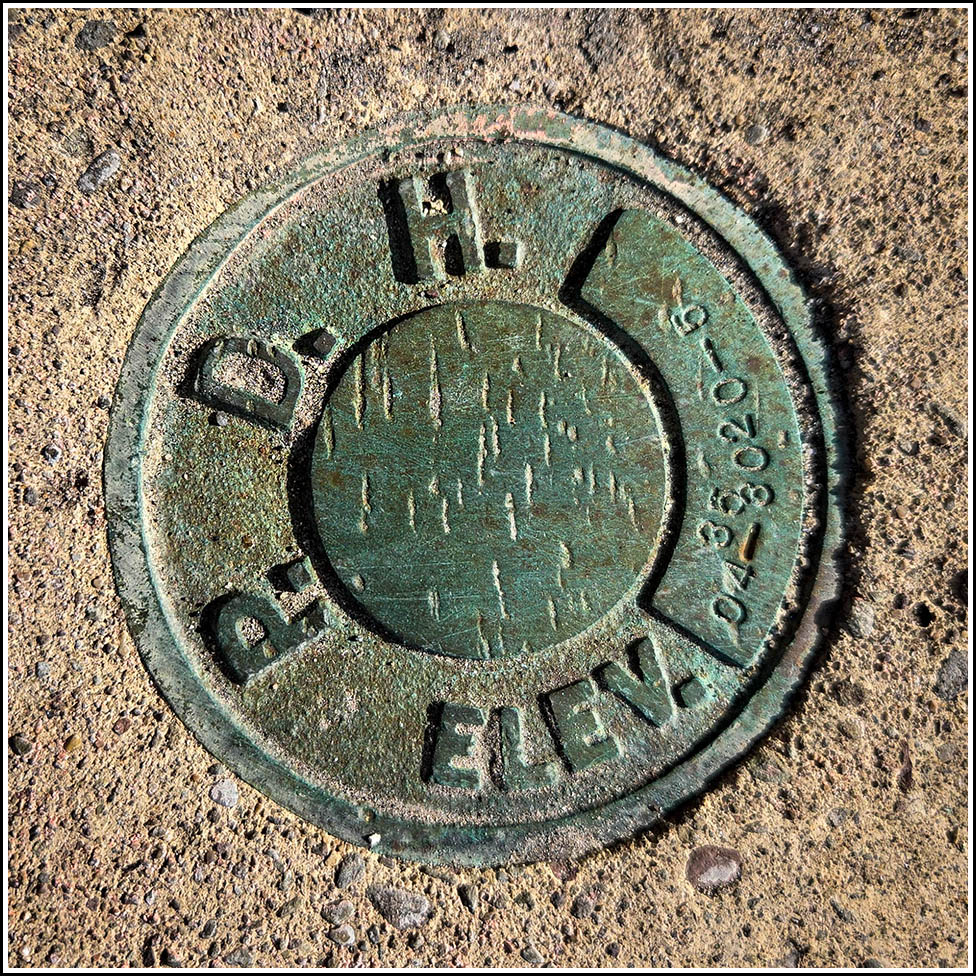
04-35-3020-5
04-35-3020-5
Recovered in Good Condition on May 26, 2026
Spatial/elevation data
| Coordinates | N 41.413244° W 75.669699° |
| Elevation | Unknown |
| Location | Pennsylvania
Lackawanna County Scranton Quad |
Mark description
| Type | Elevation Mark |
| Setting | Concrete Bridge Sidewall |
| Monumented | 2004? by PennDOT |
| Description (PennDOT) | Unavailable. |
Narrative and photographs
I recently spotted this mark on PennDOT PAMS and figured it would make a nice target for an easy walk/run while on my lunch break. It did! I took advantage of some free time on this beautiful Tuesday to search for the mark. I was curious to see whether the current construction on the Linden Street Bridge would have affected the mark. So far it hasn’t, and although I don’t know what their plans are for this bridge, the mark doesn’t appear to be in any danger at the moment. The bridge is supposed to remain open for pedestrian use throughout rehabilitation, so hopefully that means that the mark won’t be disturbed. It is in good condition at this time. I don’t know when the disk itself was set, but the stamping date is 2004.


