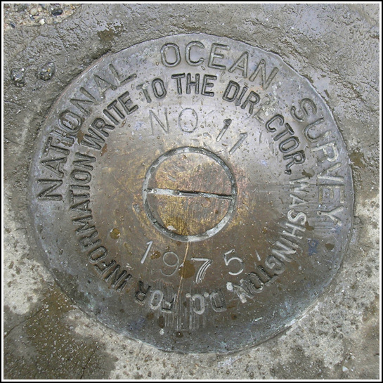
841 3320 TIDAL 11
841 3320 TIDAL 11
Recovered in Good Condition on June 26, 2006
Spatial/elevation data
| Coordinates | N 44.39225° W 68.20425° |
| Elevation | 5.103 m. |
| Location | Maine
Hancock County Bar Harbor Quad |
Mark description
| Type | Tidal Bench Mark Disk |
| Setting | Concrete Sidewalk |
| Monumented | 1975 by National Ocean Service |
| Description (National Ocean Service) | The bench mark is a disk set in the concrete walkway surrounding the Municipal Pier parking lot, 1.74 m (5.7 ft) south of the north corner of the pier, 1.37 m (4.5 ft) SW of the NE face of the pier, and 1.07 m (3.5 ft) SE of the east face of the tide gage house. |
Narrative and photographs
This tidal benchmark was not half as amusing as our previous find near the “Testes” Restaurant parking area, but it was still a neat find right on the corner of the pier, next to the NOS tide gauge station. It poured, drizzled, and the sun came out all in the three minutes it took us to find and document this mark.


