PDH
PDH
Spatial/elevation data
| Coordinates | N 41.390266° W 76.278016° |
| Elevation | Unknown |
| Location | Pennsylvania
Sullivan County Lopez Quad |
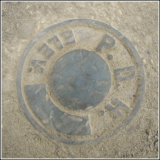
Mark description
| Type | Elevation Mark |
| Setting | Bridge Wingwall |
| Monumented | Unknown by PA Dept. of Highways |
Narrative and photographs
We were in the area of Ricketts Glen State Park for the Red Rock and Rolls event cache (geocachers’ picnic), and had planned to arrive early in order to find a cache or two before meeting everybody else at the pavilion. Not far from the starting point for Mike(Bonanza)Burnside’s intriguing Downtown Ricketts cache, I spotted the concrete bridge and thought “That would be a good spot for a benchmark.” What do you know, there was one right there just a few feet from where I stood, beneath plenty of dirt and gravel, but obvious enough. I knew that LZ0099 was somewhere nearby, but as soon as I uncovered this mark I realized this wasn’t it. Still, it was a cool bonus find! It’s located on top of the southeast wingwall of a bridge on Route 487 over Mehoopany Creek, below the level of the road. The disk has no stamping, and I can’t find a reference to it in any database. It’s a Pennsylvania Department of Highways disk like many others that do appear in the NGS database.
