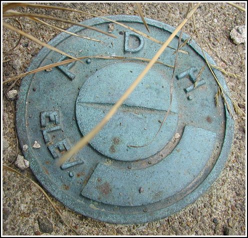
PDH (LY1365)
PDH
Recovered in Good Condition on May 9, 2003
Spatial/elevation data
| Coordinates | N 41.48795° W 75.68075° |
| Elevation | 1160.58 ft. |
| Location | Pennsylvania
Lackawanna County Scranton Quad |
Mark description
| Type | Elevation Mark |
| Setting | Bridge Abutment |
| Monumented | Unknown by PA Dept. of Highways |
| Description (NGS) | NGS Datasheet |
Narrative and photographs
Tonight I hurried over after work (and before dinner) to look for this benchmark. The description of its location on the bridge is accurate, though I don’t recommend reaching this area by traveling on the Turnpike! I turned east onto Edella Road from Abington Road (Route 407), and followed Edella Road until I passed under the Turnpike. There’s a convenient parking area on the southeast side of Edella Road, just after the Turnpike overpass and just south of the bridge. The posted coordinates were approximately 0.25 miles from the coordinates I recorded at the site. The disk is in very good condition with no stamping, as the description indicates.

