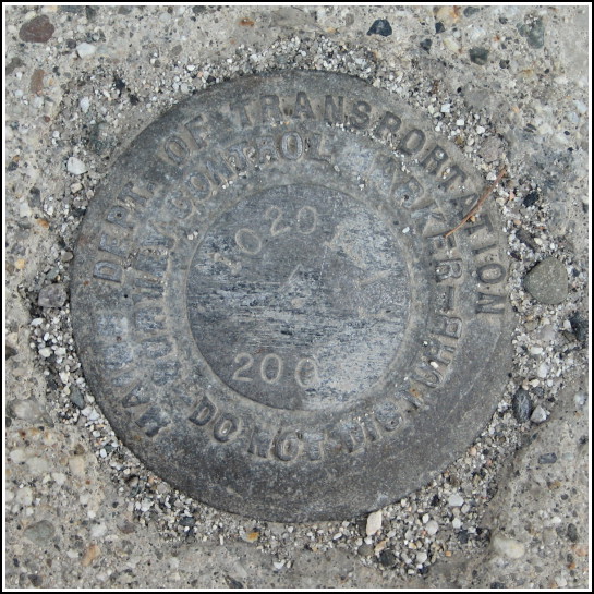
10201-11
10201-11
Recovered in Good Condition on June 21, 2008
Spatial/elevation data
| Coordinates | N 44.41365° W 68.5873° |
| Elevation | 7.372 m. |
| Location | Maine
Hancock County Blue Hill Quad |
Mark description
| Type | Survey Control Mark |
| Setting | Concrete Sidewalk |
| Monumented | 2001 by MaineDOT |
| Description (MaineDOT) |
Narrative and photographs
Rich and I spent the day at the far reaches of Acadia National Park—the section of the park on Isle au Haut. It’s quite a haul to reach the island, involving a drive to Stonington and then a ferry ride to Isle au Haut Town Landing. Needless to say, after a full day of sightseeing and hiking, we were looking for a nice supper. We remembered seeing a place in Blue Hill called the Blue Moose. What could be more perfect for us?!
After relaxing over a delicious meal, we happened to spot not just one (WO 6) but two benchmark disks on a bridge near our car! This one, a MaineDOT survey mark, is set into the sidewalk atop the bridge. The stamping is still legible, although the disk is mildly corroded.


