WO 6 (PE0346)
WO 6
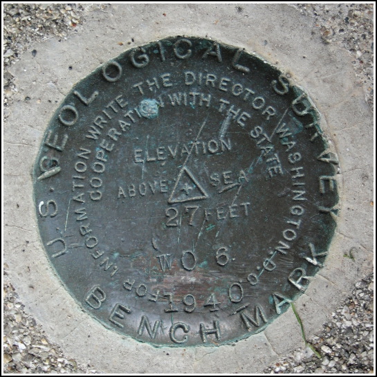
Spatial/elevation data
| Coordinates | N 44.41345° W 68.587416° |
| Elevation | 26.55 ft. |
| Location | Maine
Hancock County Blue Hill Quad |
Mark description
| Type | Bench Mark Disk |
| Setting | Concrete Bridge Sidewall |
| Monumented | 1940 by USGS |
| Description (NGS) | NGS Datasheet |
NGS recovery information
Descriptive text
Recovered in good condition.Narrative and photographs
Rich and I spent the day at the far reaches of Acadia National Park—the section of the park on Isle au Haut. It’s quite a haul to reach the island, involving a drive to Stonington and then a ferry ride to Isle au Haut Town Landing. Needless to say, after a full day of sightseeing and hiking, we were looking for a nice supper. We remembered seeing a place in Blue Hill called the Blue Moose. What could be more perfect for us?! There was even a big blue moose “sculpture” (for lack of a better word) on the front porch. Our meal was excellent and the place was quiet enough to allow us a chance to reflect on our day. With moose-bellies full, we began to walk back to the car and I happened to spot this benchmark disk on the curb of a bridge just across the street. It’s in very good condition with just some fine scratches on the surface.


.")