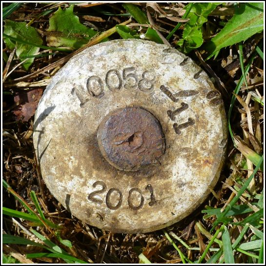
10058-11
10058-11
Recovered in Good Condition on September 5, 2013
Spatial/elevation data
| Coordinates | N 44.398683° W 68.703667° |
| Elevation | Unknown |
| Location | Maine
Hancock County Penobscot Quad |
Mark description
| Type | Traverse Rod with Disk |
| Setting | Earthen Pier |
| Monumented | 2001 by MaineDOT |
| Description (MaineDOT) | The station is located in the town of Brooksville, on the earthen pier. The station is a standard 4’ traverse rod with an aluminum disk stamped — 10058-11 2001 — driven surface into the earthen pier. It is: 4.40m(14.4ft) South-southeast of P/K Nail in Westerly most wooden pile of pier. 2.30m(7.5ft) East-southeast of C/L of Earthen pier. |
Narrative and photographs
This MaineDOT station is set into the earthen pier on the property of the Bagaduce Lunch. The disk is small and was nearly buried in the grass, so it was a challenge to find. Rich eventually spotted it during our walk along the pier. The disk appears to be in good condition. We were unable to find any evidence of the PK nail in the western-most pile of the pier.

