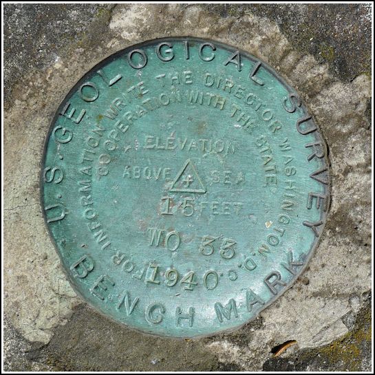
WO 33
WO 33
Recovered in Good Condition on September 5, 2013
Spatial/elevation data
| Coordinates | N 44.398233° W 68.70395° |
| Elevation | 14.754 ft. |
| Location | Maine
Hancock County Penobscot Quad |
Mark description
| Type | Bench Mark Disk |
| Setting | Rock Outcrop |
| Monumented | 1940 by USGS |
| Description (USGS) | Located 0.6 km (0.4 mi) Northeast of North Brooksville, near the wooden bridge over the narrowest part of the Bagaduce River. The station mark is a standard tablet, stamped— WO 33 1940 15 — set in the top of a rock outcrop. It is: 73.2 m (240 ft) Northeast of the bridge. 18.9 m (62 ft) North of Rte. 175 15.2 m (50 ft) East of the high tide mark of the Bagaduce River 83.8 m (275 ft) Southwest of an old pier. Coordinate was established from Route Survey Traverse as a Fly Point. |
Narrative and photographs
We were thrilled to discover that there were two survey marks on the property of the Bagaduce Lunch. We had wanted to try the famous haddock sandwich anyway, and having survey marks so close by made this a necessary stop. The haddock sandwich (and onion rings and lobster roll) were delicious, and we found both marks quite easily. WO 33 is set into a large rock outcrop in the picnic area just west of the lunch stand. It is in very good condition with all stamping clearly legible.


