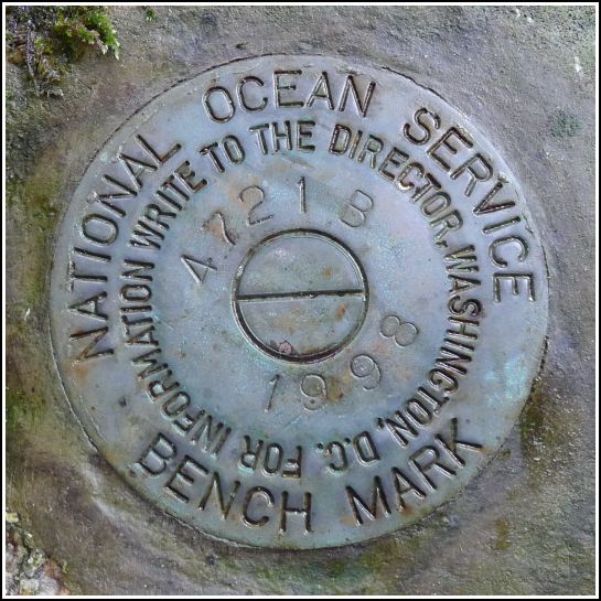
841 4721 B TIDAL
841 4721 B TIDAL
Spatial/elevation data
| Coordinates | N 44.469883° W 68.81365° |
| Elevation | 10.284 m. above MHW |
| Location | Maine
Waldo County Castine Quad |
Mark description
| Type | Tidal Bench Mark Disk |
| Setting | Boulder |
| Monumented | 1998 by National Ocean Service |
| Description (National Ocean Service) | The bench mark is a disk set in a boulder west of and uphill from the State Park pier, 24.46 m (80.2 ft) south of the north corner of the parking area, 21.21 m (69.6 ft) SSE of the west corner of the parking area, and 19.25 m (63.2 ft) ENE of the northern granite block marking the trail leading to the State Park pier. |
Narrative and photographs
We found A TIDAL last year thanks to a tip from a worker at nearby Moose Point State Park. It made sense to us that there would be at least one more disk in the series set somewhere at Fort Point, but last year, without a datasheet, we wouldn’t have had much luck searching for this mark.
Today, we came prepared with the datasheet from NOS’s Tides and Currents website. Even so, B TIDAL was a moderately challenging find. The parking area mentioned in the description is not the main parking area, but we found it easily enough. The reference from the “northern granite block” threw us off because the dimensions and directions didn’t make sense when measured from any of the existing granite blocks. Perhaps the block referred to in the description is gone or has been moved. We simply spent some time wandering the area and looking for boulders in the soggy woods (fortunately, there weren’t many) until we found the disk. It is in very good condition.
Our revisions to the description: The mark is approximately 12 ft. south of the west end of a culvert at the south end of a parking lot. The mark is approximately 10 ft. west of a path leading southeast. The mark is set on a 2 ft. x 4 ft. boulder projecting one foot.

