RICHARDSON (PE1904)
RICHARDSON
Spatial/elevation data
| Coordinates | N 44.35815° W 68.30203° |
| Elevation | 151 ft. |
| Location | Maine
Hancock County Southwest Harbor Quad |
Mark description
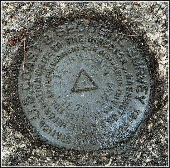
| Type | Triangulation Station Disk |
| Setting | Rock Outcrop |
| Monumented | 1870 by NGS |
| Description (NGS) | NGS Datasheet |
NGS recovery information
Descriptive text
The station mark and both reference marks were recovered in good condition, as described in the 1934 recovery. Note that the woods road is named Stanley Mountain Road.Narrative and photographs
This was to be the final survey mark find of our 2006 vacation in Acadia. After a lovely morning and afternoon spent wandering in downtown Bar Harbor, hiking around Jordan Pond, and visiting the azalea gardens, we decided one more tri-station was in order. Rich had already found this tri-station and both reference marks last year, so only one of us needed to find and photograph the marks this time (this was fortunate; the area was so buggy I’m glad we could wrap up the recovery quickly). Rich’s assistance was very much appreciated. We found all marks to be in fine condition, and to match the datasheet’s 1934 recovery note. This area is now wooded, very different from the pasture lands mentioned in 1870. The woods road (now called Stanley Mountain Road) is now paved.


| Designation | Status | Condition | Image |
|---|---|---|---|
| RICHARDSON RM 1 | Recovered | Good |
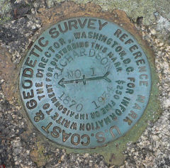
|
| RICHARDSON RM 2 | Recovered | Good |
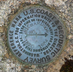
|