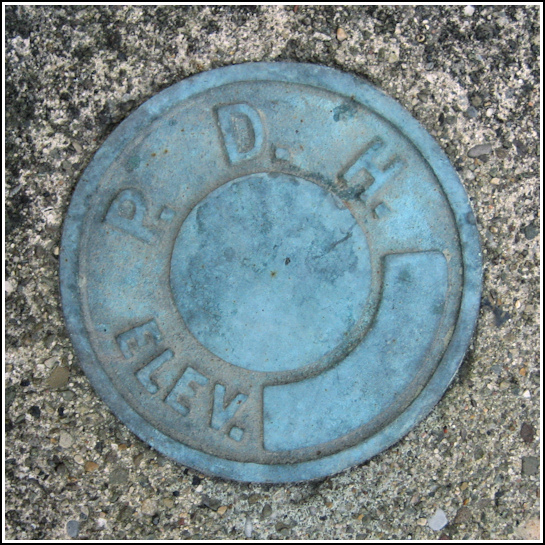
PDH
PDH
Recovered in Good Condition on December 2, 2006
Spatial/elevation data
| Coordinates | N 41.967216° W 75.588783° |
| Elevation | Unknown |
| Location | Pennsylvania
Susquehanna County Susquehanna Quad |
Mark description
| Type | Elevation Mark |
| Setting | Bridge Wingwall |
| Monumented | Unknown by PA Dept. of Highways |
| Description (PA Dept. of Highways) | Unavailable. |
Narrative and photographs
Rich and I came across this disk toward the end of a long day of geocaching and survey mark hunting, just as it was growing darker and colder and windier. We took Vinegar Hill Road from the NY border toward Lanesboro, and while waiting to turn onto Main Street, Rich happened to glance at the old concrete bridge to his right. He saw something colorful, and I got out to check. I wasn’t too surprised to see one of the typical aqua-colored, unstapdh6ed PDH disks that I’ve found on so many similar bridges. Though the cold was fierce, we managed to take a few photos and document the coordinates. This little discovery was a satisfying end to a very adventurous day!

.")