PDH
PDH
Spatial/elevation data
| Coordinates | N 41.4271° W 76.0644° |
| Elevation | Unknown |
| Location | Pennsylvania
Wyoming County Harveys Lake Quad |
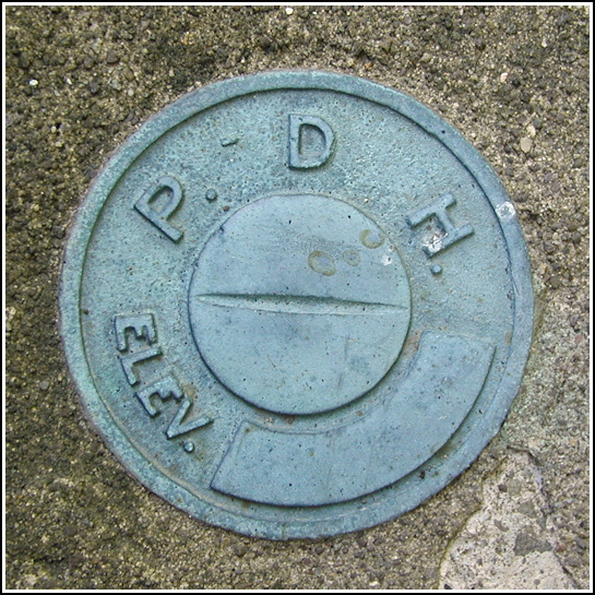
Mark description
| Type | Elevation Mark |
| Setting | Bridge Wingwall |
| Monumented | Unknown by PA Dept. of Highways |
| Description (PA Dept. of Highways) | Unavailable. |
Narrative and photographs
This warm, sunny morning was just right for some scouting missions in Wyoming County. Today, though, our main goal was to check out some possible woodchuck-hunting locations. We started out around 8:00am and reached the vegetable stand along Route 29 where we were to inquire about access to some farms in the area. Eventually we were directed to a house down the road; here we met a man and his wife who said we were welcome to hunt for woodchucks in their fields. Unfortunately, we saw nothing of note in these vegetable fields other than interesting irrigation equipment, massive pumpkin plants and a trail through the woods leading down to Bowman’s Creek.
We soon turned our attention to scouting out, by car, access to a Jeep trail we saw on the topo map. As the current configuration of roads and property no longer matches that on the map, we had no luck here either. But we did spend some time along the way looking for benchmarks, at which we were somewhat successful.
We had no description for this mark, but the coordinates Rich took from the map were good enough to point us directly to the right bridge, even the right wingwall. I wasn’t surprised when I saw the mark directly below the PDH keystone plaque. The disk appears to be in good shape, and like many similar disks is unstamped. Strangely, I was unable to find this bridge in PennDOT’s historic bridge database.


.")
