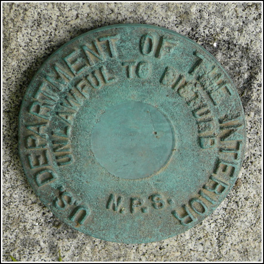
NPS (Unstamped, Acadia #4)
NPS (Unstamped, Acadia #4)
Recovered in Good Condition on June 20, 2008
Spatial/elevation data
| Coordinates | N 44.328733° W 68.2005° |
| Elevation | Unknown |
| Location | Maine
Hancock County Seal Harbor Quad |
Mark description
| Type | Boundary Monument |
| Setting | Granite Monument |
| Monumented | Unknown by National Park Service |
| Description (National Park Service) | Unavailable. |
Narrative and photographs
This is another boundary marker we spotted while driving by. Like some of the other NPS boundary markers in Acadia it has no stamped designation, and we haven’t yet been able to find any information about these disks. This one is easy to spot if you look for the brown witness post along the east side of Otter Cliff Road about 0.7 miles south of its intersection with Route 3. I checked very carefully, and despite appearances … there’s no poison ivy near the mark!
