NPS (Unstamped, Acadia #5)
NPS (Unstamped, Acadia #5)
Spatial/elevation data
| Coordinates | N 44.334316° W 68.2013° |
| Elevation | Unknown |
| Location | Maine
Hancock County Seal Harbor Quad |
Mark description
| Type | Boundary Monument |
| Setting | Granite Monument |
| Monumented | Unknown by National Park Service |
| Description (National Park Service) | Unavailable. |
Narrative and photographs
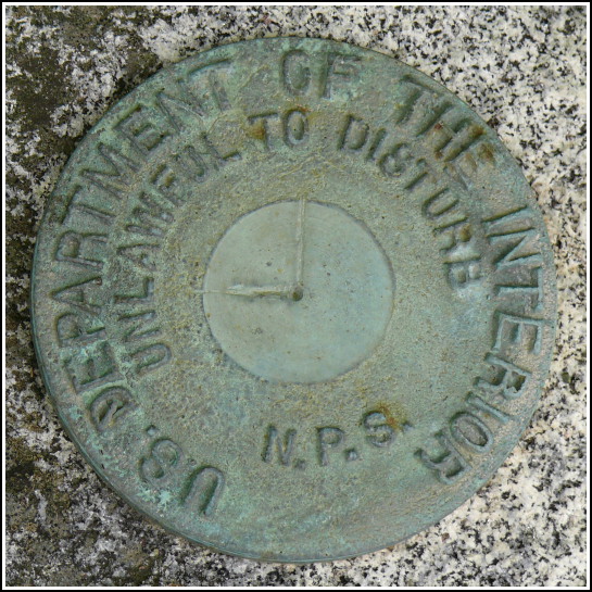
This is the third boundary marker we recovered today on our drive around the Otter Creek/Otter Cliff Road area. Like the first two, this is an NPS disk with no stamped designation, so we gave it one of our own just for identification purposes on this website. Like some other boundary disks we’ve found, there are marks chiseled in this one indicating the property corner and directions of the boundary lines. This disk is set in a granite post on the eastern side of Otter Cliff Road. Although it is marked by an orange NPS witness post like many of the other boundary markers we’ve found here, this one is set back a bit from the road and is currently overgrown, making it a bit tougher to spot and to photograph. The disk and monument appear to be in good condition.


