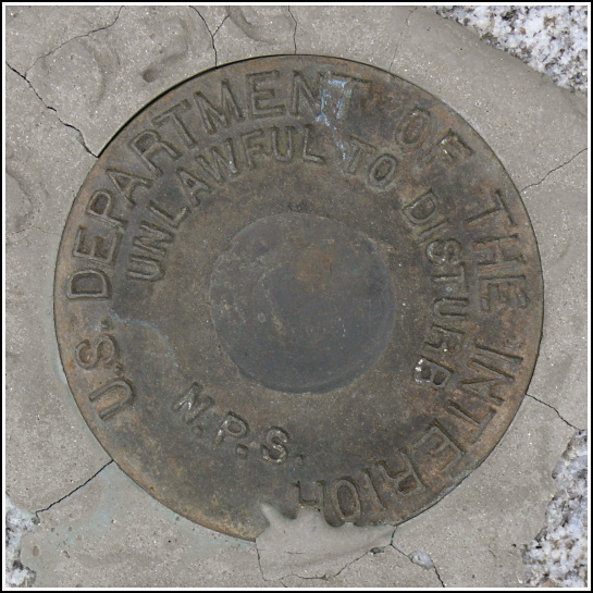
NPS (Unstamped, Acadia #3)
NPS (Unstamped, Acadia #3)
Spatial/elevation data
| Coordinates | N 44.336733° W 68.204316° |
| Elevation | Unknown |
| Location | Maine
Hancock County Seal Harbor Quad |
Mark description
| Type | Boundary Monument |
| Setting | Granite Monument |
| Monumented | Unknown by National Park Service |
| Description (National Park Service) | Unavailable. |
Narrative and photographs
This morning was wet and chilly, and after breakfast we had very little motivation to do much of anything. After a few hours, though, conditions started to improve, and we hiked the Jordan Pond Trail as our main activity for the day. Then, still searching for some inspiration, we decided to drive around and recover a few of the boundary monuments we had already spotted from the road but hadn’t stopped to photograph.
The first mark we recovered today was an NPS boundary marker, a disk with no designation (that we’re calling #3 simply because it’s the third such disk we’ve found in Acadia). The marker is located on the western side of Otter Creek Road (Maine Route 3) along a boundary between park land and private land. The disk is set in the top of a granite post and its location is indicated by a nearby NPS witness post (these bright orange posts have helped us spot many of the boundary markers in the park while driving by)! The disk and monument appear to be in good condition.


