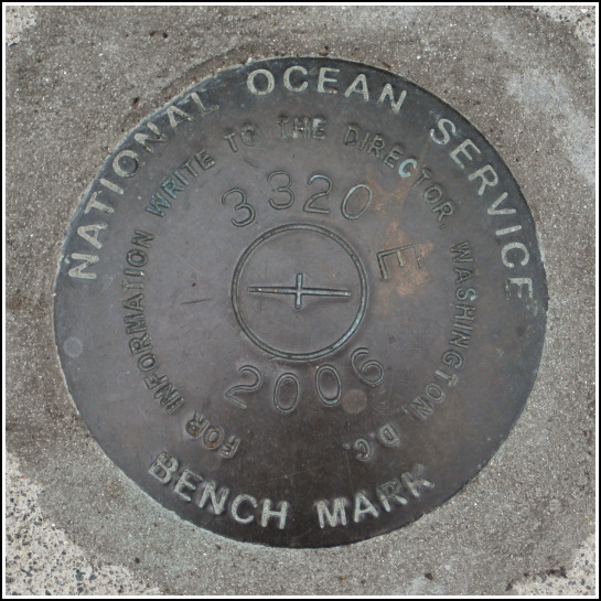
841 3320 TIDAL E
841 3320 TIDAL E
Recovered in Good Condition on June 16, 2008
Spatial/elevation data
| Coordinates | N 44.3912° W 68.2044° |
| Elevation | Unknown |
| Location | Maine
Hancock County Bar Harbor Quad |
Mark description
| Type | Tidal Bench Mark Disk |
| Setting | Concrete Step |
| Monumented | 2006 by National Ocean Service |
| Description (National Ocean Service) | The bench mark is a disk set on the north side of the park and south of the Bar Harbor pier set in the second step off of West Street located 48.27 m (158.4 ft) east of the center line of Main Street, 13.62 m (44.7 ft) south of the center line of West Street, 0.57 m (1.9 ft) north from the top of stairs, and 0.46m (1.5 ft) west of the east edge of stairs, 0.28 m (0.9 ft) above West Street set in concrete steps on the south side of West Street and on the north side of the park. |
Narrative and photographs
With Danish, scone, tea and coffee from Morning Glory in hand, we made our way to our favorite breakfast spot, the gazebo in Agamont Park. We happened to take a slightly different route (up the steps from West Street into the park), and to our surprise, we spotted a new tidal station disk set into one of the steps! It’s only two years old, and is part of the same series we’ve recovered marks from before. (841 3320 is the Bar Harbor tidal station designation, and there are at least ten marks in the series set over a period of several decades—some date back to 1975.) This new disk is in very good condition; hopefully it stays that way in such an exposed location.


