911.09 (LY1348)
911.09
Spatial/elevation data
| Coordinates | N 41.497083° W 75.538366° |
| Elevation | 911.10 ft. |
| Location | Pennsylvania
Lackawanna County Olyphant Quad |
Mark description
| Type | Chiseled Cross |
| Setting | Concrete Culvert |
| Monumented | by Delaware and Hudson Railroad |
| Description (NGS) | NGS Datasheet |
Narrative and photographs
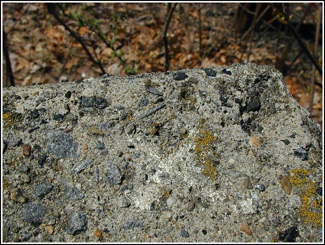
This was the fifth stop on today’s benchmark bike tour. Since I had Rich’s excellent, complete description at my disposal, this wasn’t too difficult for me to find. The white paint was helpful, too. The mark is significantly smaller than the other chiseled crosses we’ve found.

(Recovered on April 20, 2003)
N 41° 29.825’ W 075° 32.302’
This vertical control station was rather difficult to locate. The historical description leads reliably to the site. A very fine chiseled cross, approximately 1 inch by 1 inch, is barely discernable in the extreme northwest corner of the top surface of the west parapet of a 12-foot stone arch culvert over White Oak Creek. The concrete surfaces appear to have been weathered considerably since its construction in 1907. Within the mark there remain some flecks of white paint which may have been used at one time to help define it. At the station mark my Garmin GPSmap76 receiver indicated 464 feet from the NGS datasheet coordinates. ~Rich in NEPA~


