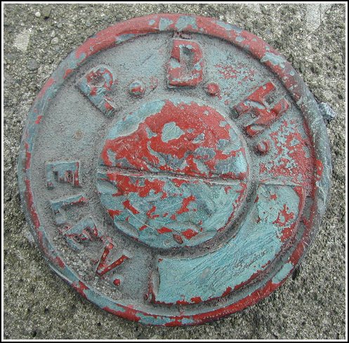
509 PADH (LY0566)
509 PADH
Recovered in Good Condition on February 2, 2003
Spatial/elevation data
| Coordinates | N 41.327033° W 74.797233° |
| Elevation | 508.61 ft. |
| Location | Pennsylvania
Pike County Milford Quad |
Mark description
| Type | Survey Mark |
| Setting | Concrete bridge headwall |
| Monumented | Unknown by PA Dept. of Highways |
| Description (NGS) | NGS Datasheet |
Narrative and photographs
It was a little tricky to find the concrete bridge. At first we stayed on Route 209, missing the point at which that route and Broad Street diverge. After realizing we’d gone too far beyond the correct area, we turned around and I spotted the bridge through the trees. The marker itself was an easy find, thanks to the description and photos given by patw.
