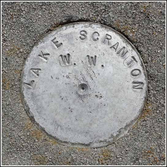
LAKE SCRANTON W. W.
Spatial/elevation data
| Coordinates | N 41.379586° W 75.633405° |
| Elevation | Unknown |
| Location | Pennsylvania
Lackawanna County Scranton Quad |
Mark description
| Type | Unspecified Disk |
| Setting | Bridge Wingwall |
| Monumented | Unknown by Unknown Agency |
Narrative and photographs
The rain showers we expected today never materialized, so after breakfast at Zummo’s Cafe Rich, my father, and I drove to Lake Scranton for a leisurely 3.5-mile walk—along with half of Lackawanna County, I think. It’s been a long, cold winter.
While rounding the southern end of the lake, on a long concrete bridge wingwall near the dam, I spotted a small disk which is undoubtedly some sort of survey marker. It’s stamped LAKE SCRANTON W.W., which we assumed stands for “water works”.
There is a similar disk, LAKE SCRANTON PAV., on the opposite end of the lake, at an overlook that was once a pavilion (now only the base remains). Rich and I found that mark over ten years ago. This one looks to be as old, so I wonder why we never noticed it before. The mark has no stamping other than its designation, so the data is quite limited.

