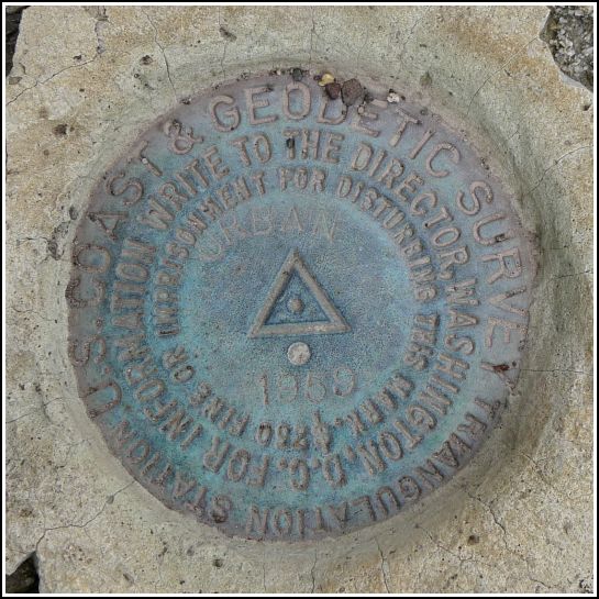
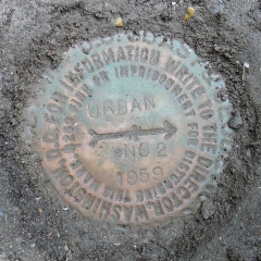
URBAN
Spatial/elevation data
| Coordinates | N 41.359667° W 75.379363° |
| Elevation | 1390.42 ft. |
| Location | Pennsylvania
Wayne County Sterling Quad |
Mark description
| Type | Triangulation Station Disk |
| Setting | Boulder |
| Monumented | 1959 by NGS |
| Description (NGS) | NGS Datasheet |
NGS recovery information
Descriptive text
The station and reference mark 2 were recovered in good condition as described. Reference mark 1 was not found. The azimuth mark was confirmed destroyed in 1974. A standard metal witness post marks the site of the station.Narrative and photographs
What better way to complete a day of hiking (at Bruce Lake) and eating (at Der Jaeger) than with a tri-station search? There’s just something amusing about finding a station called URBAN right next to a barn. (Yes, I assume this station is named for a previous landowner and not meant as a description of the surrounding countryside, but what fun is that.)
The station mark is situated as described, except that state highway 90 is now PA Route 191. The original witness post is still in place. RM 1 was not found. We found indications of a culvert at approximately the correct distance from the station but it appears to be more modern than the standard rock culvert style, and is mostly covered with a thick layer of soil and gravel. RM 2 was an easy find on the opposite side (southwest) of Route 191. The disk is set into a concrete monument just a few inches from the corner of a barn. It was covered with a thin layer of soil and grass that was easily removed. The azimuth mark was not searched for, as it was noted as destroyed in the 1974 recovery.


| Designation | Status | Condition | Image |
|---|---|---|---|
| URBAN AZ MK | Not Found | Unknown (Not Found) |

|
| URBAN RM 1 | Not Found | Unknown (Not Found) |
|
| URBAN RM 2 | Recovered | Good |
|