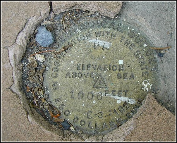
C 3 USGS (KV2794)
C 3 USGS
Recovered in Good Condition on September 21, 2002
Spatial/elevation data
| Coordinates | N 40.860087° W 75.59269° |
| Elevation | 1005.10 ft. |
| Location | Pennsylvania
Carbon County Palmerton Quad |
Mark description
| Type | Bench Mark Disk |
| Setting | Concrete Sidewalk |
| Monumented | 1922 by USGS |
| Description (NGS) | NGS Datasheet |
NGS recovery information
Descriptive text
Recovered in good condition. As noted in the 1956 recovery, the sidewalk may have settled. The building is now the Jack River Smokehouse restaurant. Handheld GPS coordinates for the bench mark are 40 51 36.3(N) 075 35 33.7(W).Narrative and photographs
I found this one after locating KV2795 down the road. Apparently the Forest Inn no longer exists as such, but Aaron said he thought it was probably the restaurant we’d passed on our way to the Preacher’s Camp geocache. When I saw the three foot high ‘sidewalk’ out front, I knew it was the place even though it now has a different name. The mark was easy to find: it was located just where the description stated, though the coordinates were about 200 feet off. I felt a little weird walking around on the porch of this restaurant; the guys who were arriving for work this evening were giving me some strange looks, but I just ignored them, took a photo and got out of there. I wonder how many of those guys ever noticed the marker?
")