BM #4 (04-2-1)
BM #4 (04-2-1)
Recovered in Good Condition on November 21, 2009
Spatial/elevation data
| Coordinates | N 41.414583° W 75.506033° |
| Elevation | 1766.3 ft. |
| Location | Pennsylvania
Lackawanna County Olyphant Quad |
Mark description
| Type | Elevation Mark |
| Setting | Concrete bridge headwall |
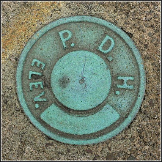
| Monumented | 1999 by PA Dept. of Highways |
| Description (PA Dept. of Highways) | The station is a PDH disk in the top Southern end of the East concrete headwall of a plat arch bridge at SR 0247 Segment 30, and approximately 0.3 miles North from the intersection of SR 0247 and SR 0348 on the right. See: 4270.pdf. |
Narrative and photographs
We were on our way back home after searching for a few marks in Madison Township when I spotted a bright blue disk on a culvert headwall off Moosic Lake Road. Rich found a safe spot to pull over and I investigated the mark. It’s an old PA Dept. of Highways disk without any stamping, but that I later discovered is desginated BM #4 (04-2-1). The description from the PennDOT datasheet is available below.

