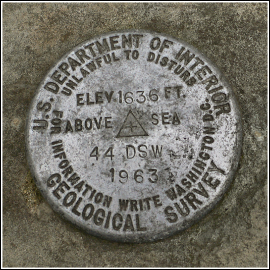
44 DSW
44 DSW
Recovered in Good Condition on November 21, 2009
Spatial/elevation data
| Coordinates | N 41.381133° W 75.475266° |
| Elevation | 1635.676 ft. |
| Location | Pennsylvania
Lackawanna County Lake Ariel Quad |
Mark description
| Type | Bench Mark Disk |
| Setting | Boulder |
| Monumented | 1963 by USGS |
| Description (USGS) | Drinker, about 1.1 mi SW. of; on rd. leading to Aberdeen; about 70 ft NW. of junction of T-rd. SE.; in large rock; standard tablet stamped “44 DSW 1963 1636” |
Narrative and photographs
I didn’t know what to expect when we did our preliminary investigation on this mark from home. The large rock is clearly visible on Google Street View, but it’s so close to the road that we had every reason to suspect that the mark was probably long gone. It was a very pleasant surprise to find that it’s still in place and in excellent condition! The disk is a cookie-style aluminum USGS disk (I call them that because they are thicker than the typical NGS disks and appear, well, cookie-like as a result).
 set into the boulder.")

