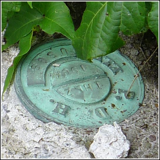
1 HLZ
1 HLZ
Recovered in Good Condition on July 4, 2014
Spatial/elevation data
| Coordinates | N 41.48188° W 75.44609° |
| Elevation | 1416.097 ft. |
| Location | Pennsylvania
Wayne County Lake Ariel Quad |
Mark description
| Type | Elevation Mark |
| Setting | Bridge Wingwall |
| Monumented | 1964 by USGS |
| Description (USGS) | South Canaan, 2.7 mi SW. of, along state hwy. at bridge over large drain; 20 ft NW. and 0.5 ft lower than center of bridge; in NW. wingwall; PDH standard disk stamped “1 HLZ 1964 USGS” |
Narrative and photographs
We’re in this area at least once a year for our friend Dave’s annual 4th of July picnic at Lake Spangenberg. For various reasons (usually because the weather is miserable!) we haven’t used the opportunity to search for benchmarks in the area. This year, I decided to change that, and we selected two marks that looked like they would be simple and quick finds.
It was easy enough to find 1 HLZ and read the designation, but there’s no way I was about to move the poison ivy covering the mark to get a better photo. The disk appears to be in good condition and is set as described, in the northwest wingwall of a small bridge along Cortez Road (S.R. 3018).

