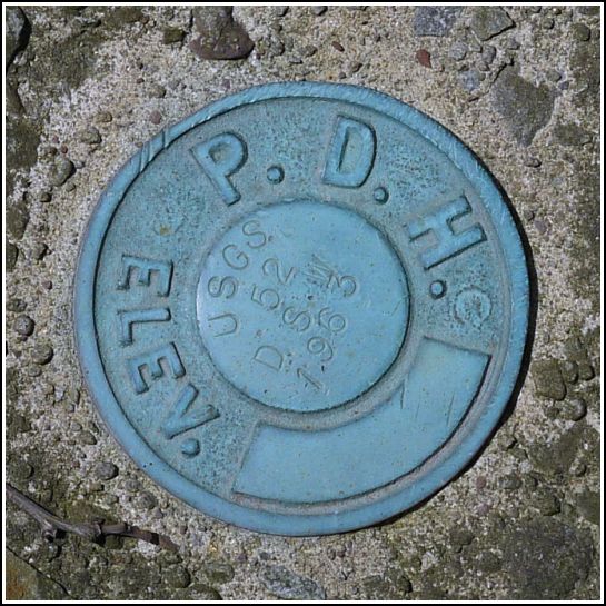
52 DSW
52 DSW
Spatial/elevation data
| Coordinates | N 41.503194° W 75.417388° |
| Elevation | 1335.123 ft. |
| Location | Pennsylvania
Wayne County Waymart Quad |
Mark description
| Type | Elevation Mark |
| Setting | Bridge Wingwall |
| Monumented | 1963 by USGS |
| Description (USGS) | South Canaan; 0.3 mi SW. of crossroad; 20 ft S. of, and about 0.5 ft higher than center of bridge; in SW. wingwall of bridge over large drain; PDH standard disk stamped “52 DSW 1963 USGS” |
Narrative and photographs
This find was a fitting end to an exciting day of benchmark hunting! 52 DSW was among the original four marks we had planned on searching for today. The description is accurate and it took us right to the correct spot, and I found the mark easily. There was no good way to climb down to the level of the wingwall, so I photographed the disk from above while drivers flew by, eyeing me up, as Rich described it later, even as they sped past. I had assumed that by wearing my safety green “SURVEY STATION RECOVERY” shirt most people would assume I was just working and would ignore me but no, they seemed as curious/nosy as ever.
The disk is in good condition and the description is accurate. The bridge is located along Cortez Rd. (SR 3018) just southwest of its intersection with Route 296 in South Canaan. An unusual feature of this mark is the “BM 1335-1” painted on the bridge banister near the southwest wingwall.


