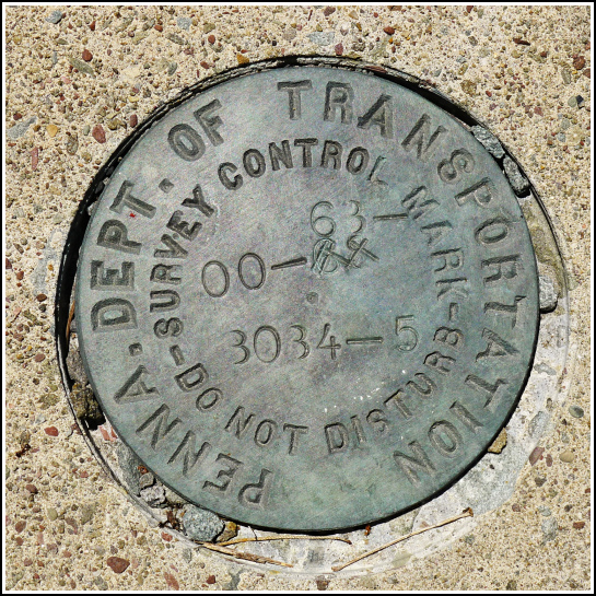
00-63-3034-5
00-63-3034-5
Recovered in Good Condition on July 6, 2014
Spatial/elevation data
| Coordinates | N 41.48227° W 75.39831° |
| Elevation | Unknown |
| Location | Pennsylvania
Wayne County Lake Ariel Quad |
Mark description
| Type | Survey Control Mark |
| Setting | Bridge Wingwall |
| Monumented | 2000? by PennDOT |
| Description (PennDOT) | Unavailable. |
Narrative and photographs
On our way back from a hike at Varden Conservation Area (Mid Valley tract), we stopped to check out a few bridges along Mid Valley Road. On the east wingwall on the south side of this small bridge over Middle Creek we found this PennDOT survey control mark. It is in very good condition and is recessed into a hole that’s larger than it needed to be (and some small pieces of gravel had worked their way into the gap). It was a strange setting that we’ve never seen before. There was also a mistake in the initial stamping that was crossed out and restamped correctly and legibly above. It appears that the “3” was initially stamped backwards.

